
News
S-NPP VIIRS and CERES Data Synergy in generating Earth Radiation Budget Data Products
 By Sunny Sun-Mack
The Suomi National Polar-orbiting Partnership (Suomi NPP) is a weather satellite operated by NOAA. It was launched in 2011 and continues to operate today. Suomi NPP carries 5 instruments, two of which are the Clouds and the Earth’s Radiant Energy System (CERES) and the Visible Infrared Imaging Radiometer Suite (VIIRS).
Understanding the relationship between clouds with solar and longwave radiation processes requires determination of the cloud distribution and radiation budget, as well as the associated cloud microphysical and macrophysical properties. The NASA CERES Project was designed to facilitate this understanding by measuring the Top of Atmosphere (TOA) radiation fields simultaneously with cloud properties using instruments onboard the same spacecraft, like VIIRS or MODIS instruments along with CERES instrument, to provide global and diurnal coverage. The CERES scanners measure broad-band shortwave and combined (total) shortwave and longwave radiances. Data from VIIRS and MODIS are used for discriminating between clear and cloudy scenes, and for retrieving the properties of clouds in the case of cloudy scenes and the aerosols for the clear scenes. Those cloud properties, including cloud fraction, phase, temperature, height, optical depth, effective particle size, and condensed/frozen water path, are the key parameters needed to link the atmospheric radiation and hydrological budgets.
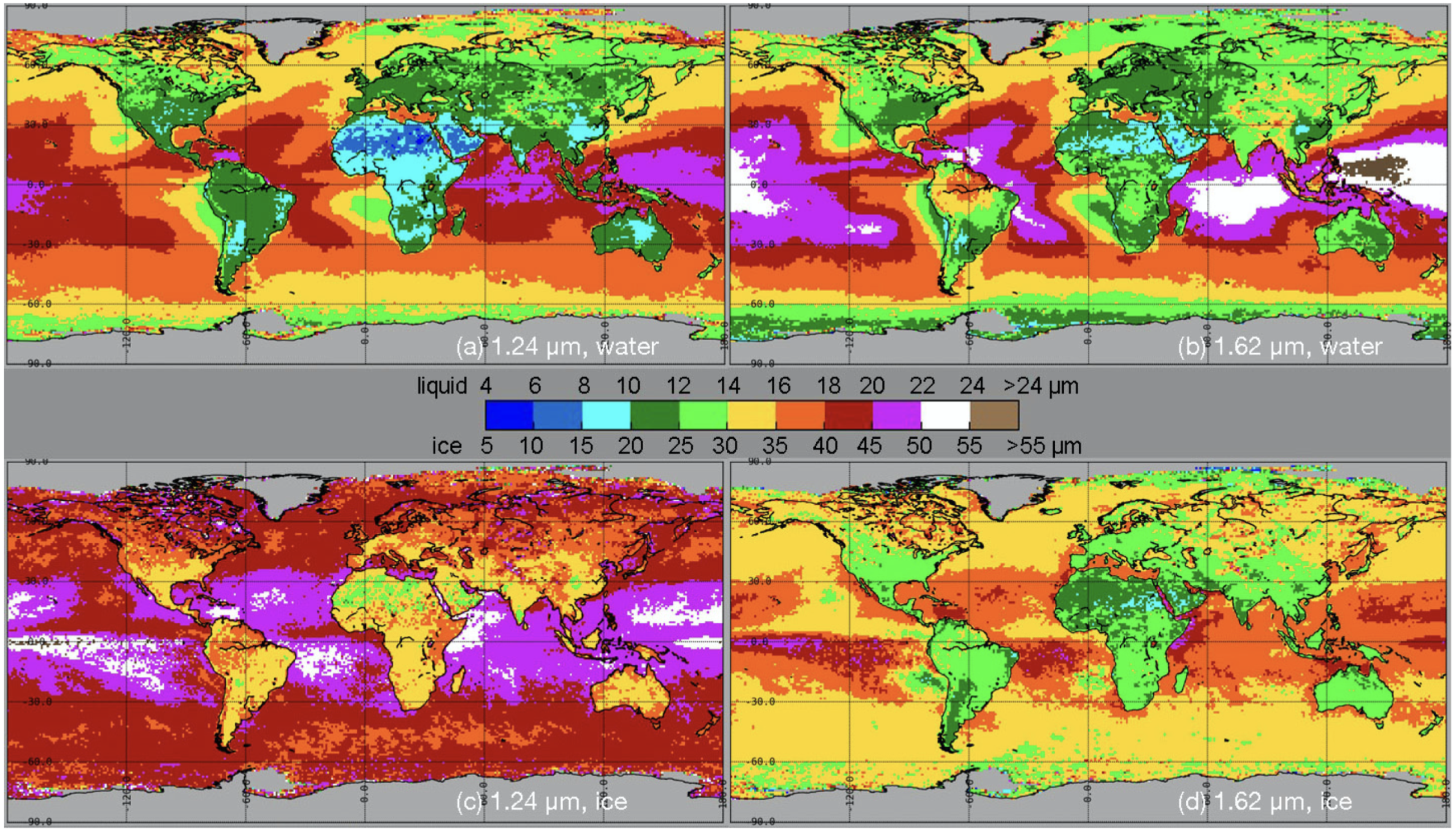
Two publications from CERES-VIIRS Edition 1 algorithms and data products were just circulated by journal, Remote sensing. The first paper, "VIIRS Edition 1 cloud properties for CERES. Part 1: Algorithm adjustments and results," was featured on the cover of the February issue #1 of the journal Remote Sensing and was authored by members of SSAI and NASA Langley - Patrick Minnis, Sunny Sun-Mack, Bill Smith, Jr., Qing Z. Trepte, Gang Hong, Yan Chen, Christopher R. Yost, Fu-Lung Chang, Rita A. Smith, Patrick W. Heck and Ping Yang. Results are presented for the period 2012-2020. With some notable exceptions, the VIIRS cloud properties provide a consistent addition to the CERES MODIS cloud data record. The URL of the paper at: https://www.mdpi.com/2072-4292/15/3/578
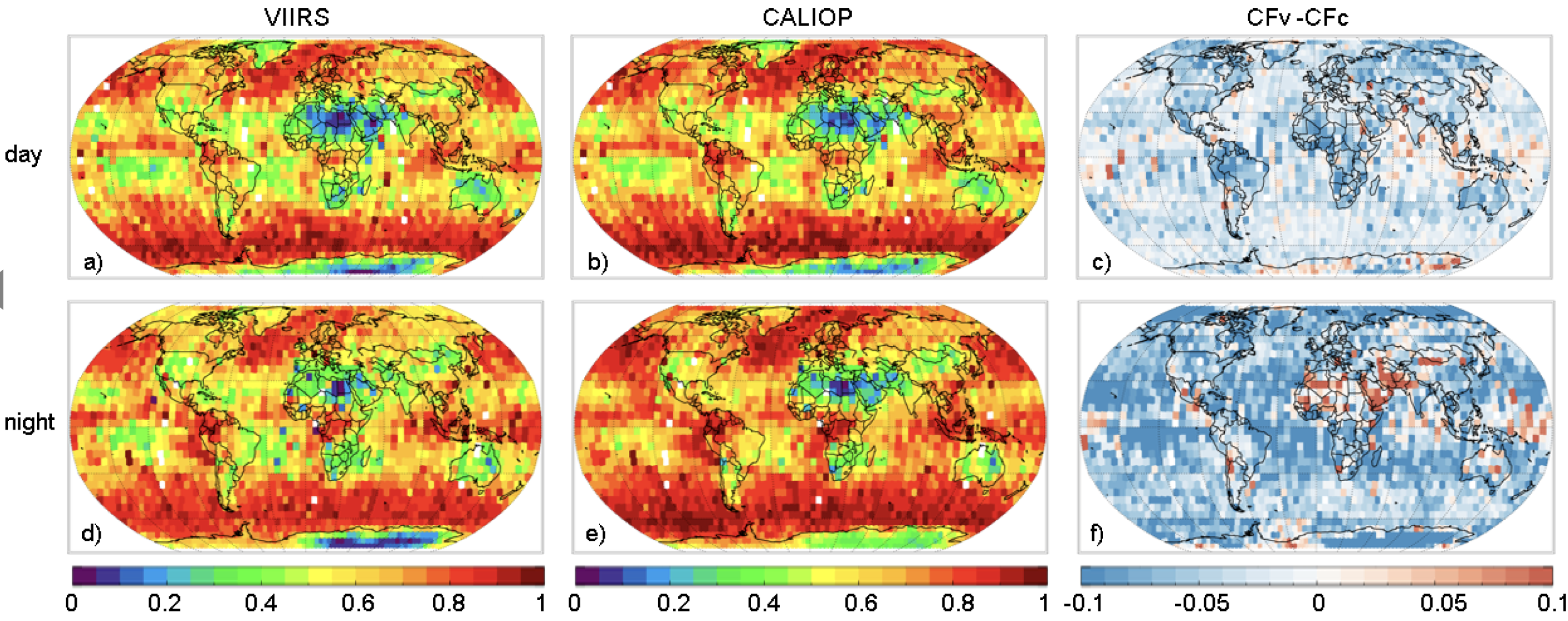
The second paper, "VIIRS Edition 1 cloud properties for CERES. Part 2: Evaluation with CALIPSO," was published in the VIIRS Special Issue of the journal, Remote Sensing, by Chris Yost, Patrick Minnis, Bill Smith, Jr., Sunny Sun-Mack and Qing Trepte. Cloud fraction, phase, and top heights retrieved from the VIIRS on the SNPP satellite using the CERES Edition 1 algorithms were compared to matched 2015-16 data from the CALIPSO lidar, CALIOP. The accuracies of the CERES-VIIRS cloud fractions are found to be as accurate or more so than those from the CERES cloud amounts determined from MODIS data on the Aqua platform as well as two other operational algorithms used by other groups. The URL of the second paper can be found at: https://www.mdpi.com/2072-4292/15/5/1349