
News
World Meteorology Day - Forecasting for Science
by Tracey Bien-Aime
In thinking about World Meteorology Day today, we wanted to highlight some of the meteorological work we do which is a bit outside what you might think about when you think of weather forecasting.
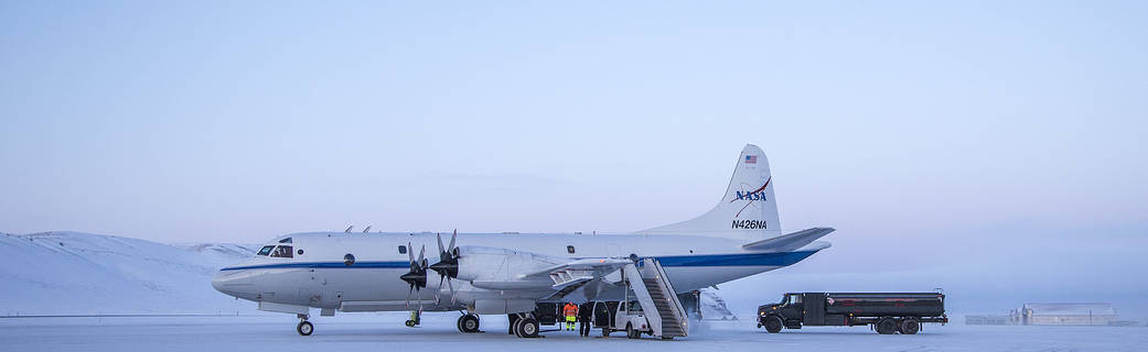
SSAI meteorologists work as part of monitoring and validation teams during field missions provided 24-, 48-, and 72-hour weather forecasts to help scientists and pilots determine the best possible flight path for collecting data. During these missions, specially equipped planes fly over a designated area collecting data from instruments installed into the planes. They are looking for flight paths in the study area that are free from cloud cover, rain, and smoke contamination. SSAI employees provide pilots with the conditions for those days during field missions. Sometimes, they must provide such weather forecasts in a box shape – telling them to fly only within a certain latitudinal and longitudinal area that boxes them into a designated “clear” area.
Forecasts are produced every day, including over the weekends, using public tools like NOAA’s Global Forecast System (GFS) and the European Center for Medium-Range Weather Forecasts (ECNWS) data, and research-only tools such as the GEOS research forecasting system model. Field missions are conducted for weeks at a time, so our employees work in shifts to cover each other’s vacation and to ensure that they can continue providing the daily forecasts. SSAI’s Dr. Marangelly Fuentes talked about her time working on Operation IceBridge and how it “felt like being in an operational weather service” due to the shift work and constant forecasting.
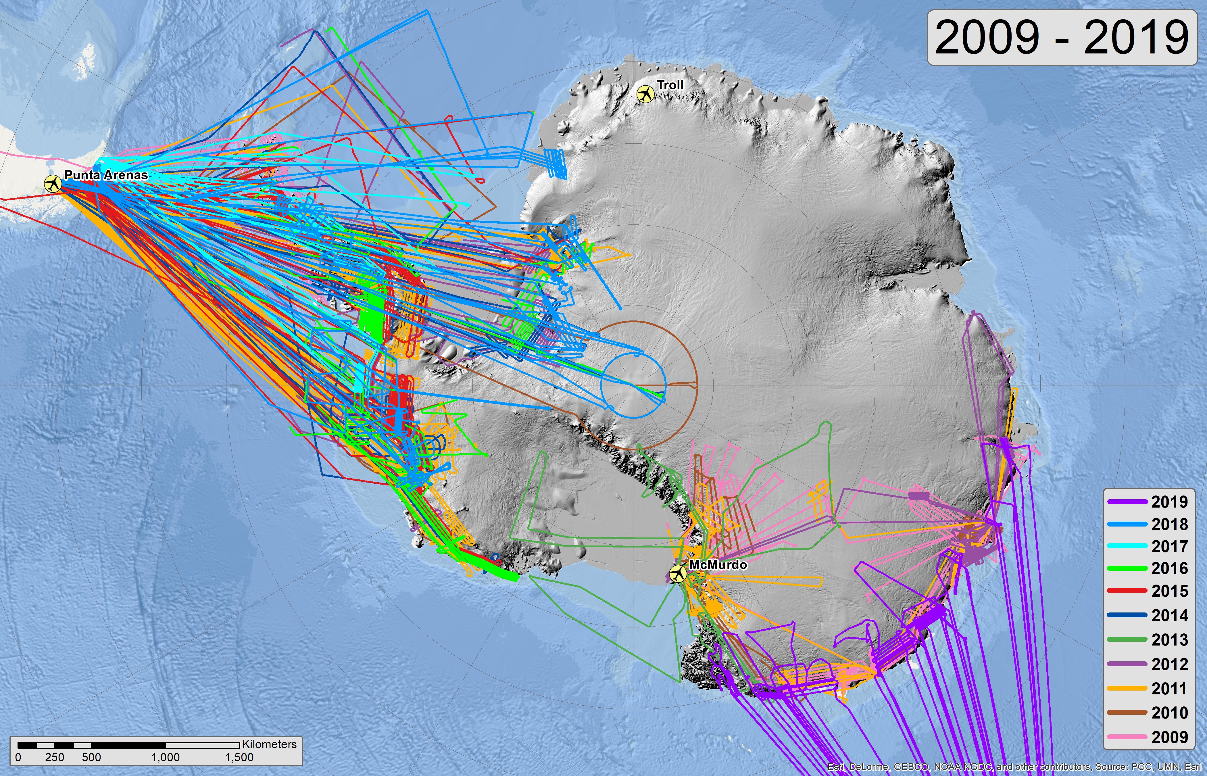
Operation IceBridge in Antarctica was the largest airborne survey of polar regions ever, done to bridge the gap between the end of the ICESat satellite mission in 2010 and the beginning of the ICESat-2 satellite mission in 2018. Planes would fly out from the tip of South America to map hundreds of miles of the Antarctic. Our scientists and researchers involved in these campaigns never know what they might be asked to include when determining the best flight paths.
Dr. Fuentes said that at one point the pilots began requesting temperature data for the flight levels. She found out that the reason this was requested was because below a certain temperature, the fuel in the planes would begin to turn to a gel consistency and one plane had a difficult time getting safely back to South America.
SSAI employees provide these forecasts for many of NASA’s field missions, helping to ensure research data can be properly collected and that the pilots and scientists on those planes can remain safe while doing so.